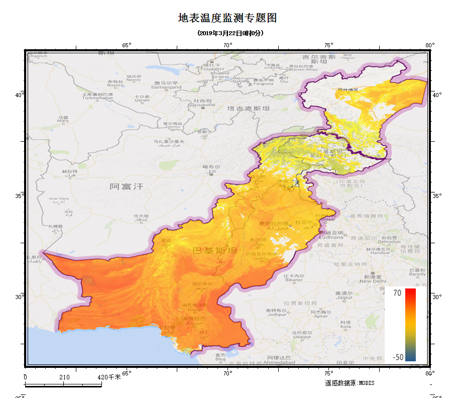
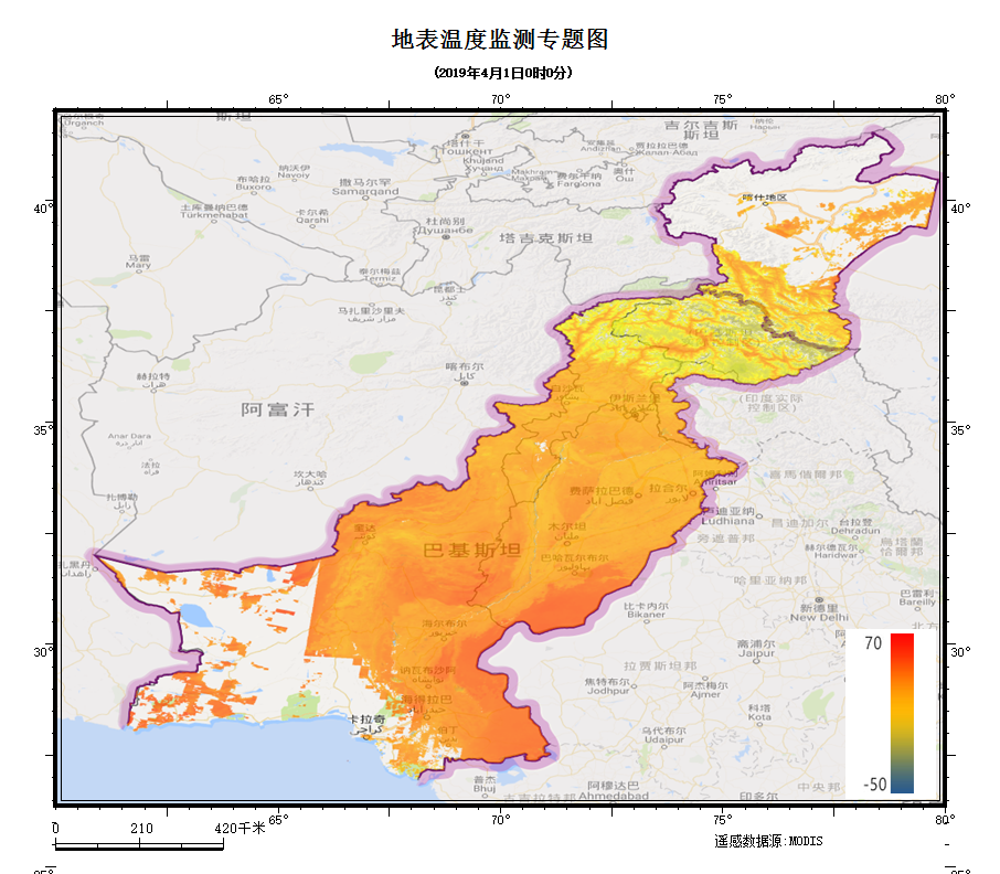
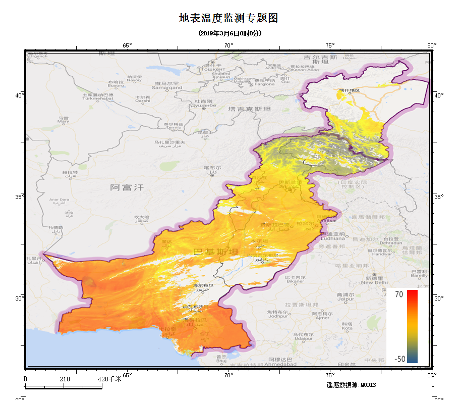
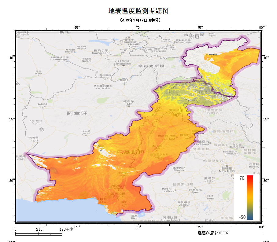
Explain
Based on the remote sensing data MODIS surface temperature data product, the desertification degree of China Pakistan Economic Corridor is evaluated by using the difference index of desertification (DDI), and the normalized vegetation index (NDVI) and albedo are used as the monitoring indexes. By constructing the albedo NDVI feature space, and using the negative correlation between albedo and NDVI, the DDI formula is constructed to complete the year-on-year desertification of China Pakistan Economic Corridor The thematic data set of desertification classification can directly reflect the desertification degree of China Pakistan Economic Corridor and provide reference for quantitative assessment of desertification severity. The data can provide basic data support for the regional scientific research of China Pakistan Economic Corridor.
Data related to mod13a3 and mcd43a3 include: h23v04, h23v05, h23v06, h24v04, h24v05, h24v06, data resolution is 1km, monthly synthesis
Taking the normalized vegetation index (NDVI) and albedo as the monitoring index, the characteristic space of albedo NDVI is constructed, and the DDI is constructed by using the negative correlation between albedo and NDVI.