Recently, a series of data sets produced by the national science and technology basic resource survey special project "Survey of Permafrost Background and Freeze-Thawing Disasters at High Latitude in Northeast China" undertaken by the researcher Li Guoyu of the Northwest Institute of Ecology, Environmental Resources, China Academy of Sciences, were officially released in the National Glacier, Permafrost and Desert Science Data Center (www.ncdc.ac.cn), and scientific researchers are welcome to download and use it.
The high-latitude permafrost region in Northeast China is the largest soil organic carbon pool and an important ecological barrier area in Northeast China. It is also a hub area for transportation and oil pipeline projects connecting China, Mongolia and Russia. Affected by the degradation of frozen soil, the region's water conservation functions, forest and wetland ecosystems and carbon cycle processes have undergone significant changes, and the problem of engineering freezing damage is also very prominent. Identifying the background data of permafrost and the distribution and characteristics of freeze-thaw disasters in the region is of great scientific and practical significance in the above fields.
A total of 46 data sets were generated in this survey, focusing on typical river basins on the east and west slopes of the Daxinganling Mountains and the entire permafrost area in Northeast China, covering a complete set of measured and spatial features of frozen soil in multiple time series (2010-2015) and multi-scale (30m-1km). Special data. Including electromagnetic and radar field detection and borehole in-situ ground temperature observation data, supporting refined thematic mapping of frozen soil depth, thickness, temperature, underground ice reserves, etc.; integrating ecological foundation background data such as topography, land use, vegetation soil, and formation heat. Synchronously collect ground temperature monitoring data of key projects along roads, railways, and oil and gas pipelines along the line, carry the results of freeze-thaw disaster zoning, risk assessment, engineering freezing damage and foundation stability evaluation across the region, supplement auxiliary background data of meteorology, population, and long-term temperature, and support field scientific research ledger and comprehensive evaluation report of frozen soil projects comprehensively support scientific research and practical work related to frozen soil mechanism research in cold regions, ecological hydrological simulation, linear engineering disaster prevention and reduction, and frozen soil regional safety planning.
Project support: National Science and Technology Basic Resources Survey Special Project: Survey of Permafrost Background and Freeze-Thawing Disasters at High Latitude in Northeast China (2022 FY100700).

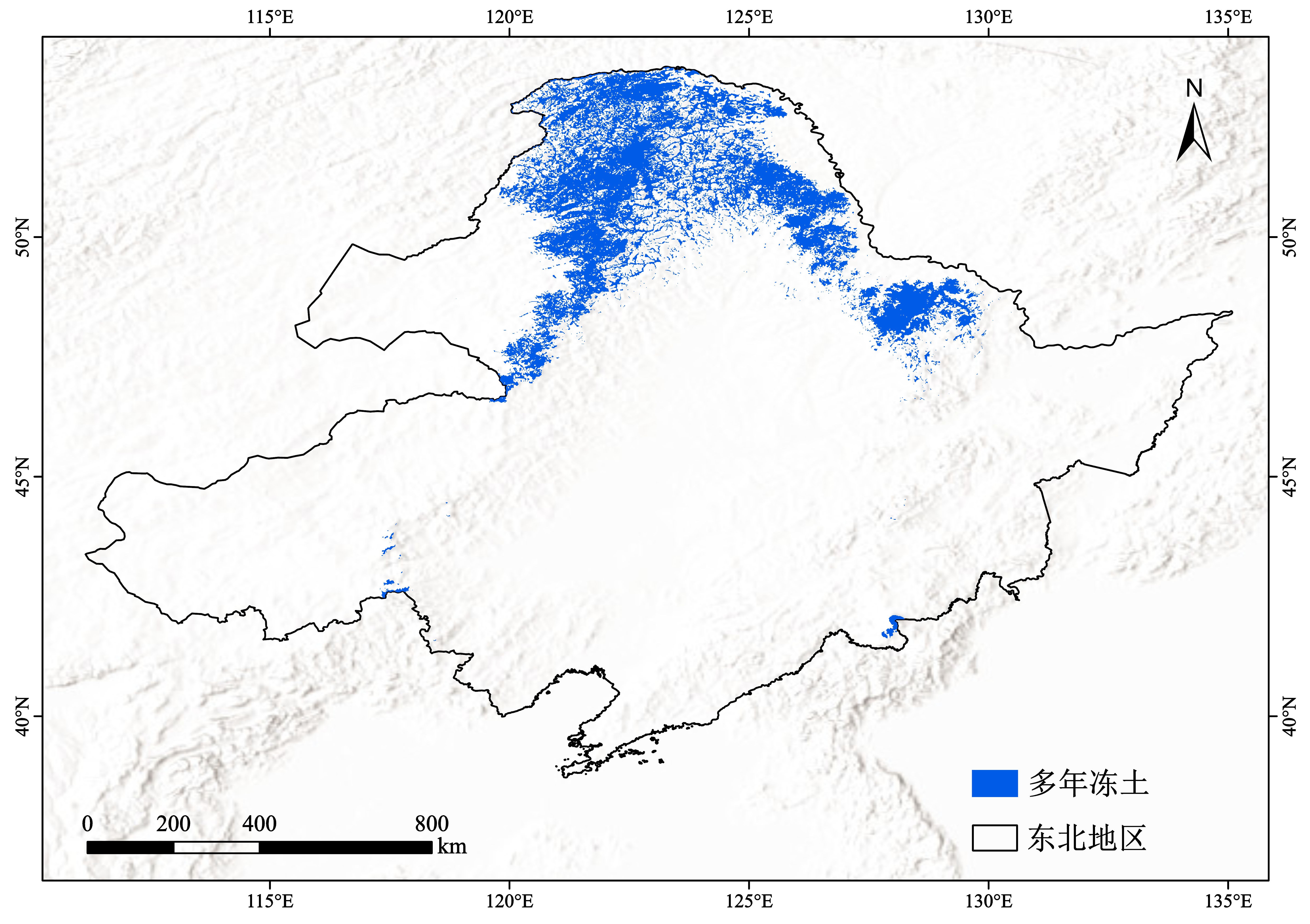
图1 东北1km多年冻土分布图(2023-2024年)

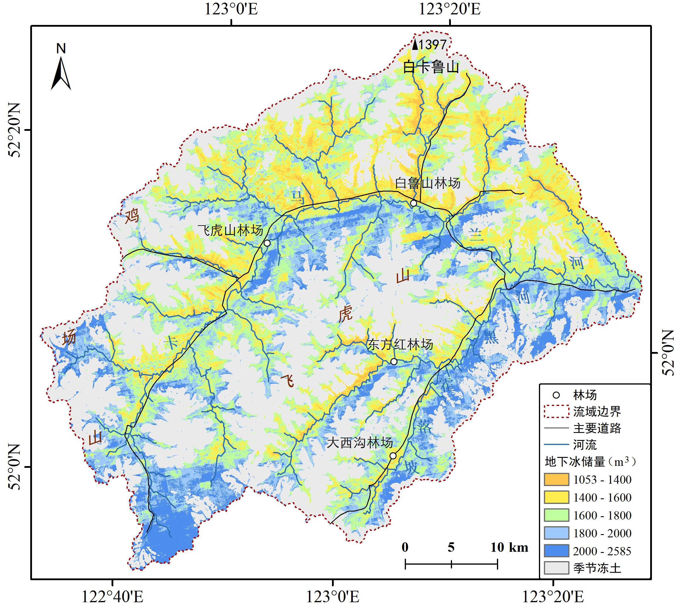
图2 大兴安岭东坡塔河地区卡马兰河流域30m多年冻土地下冰储量图(2023-2024年)

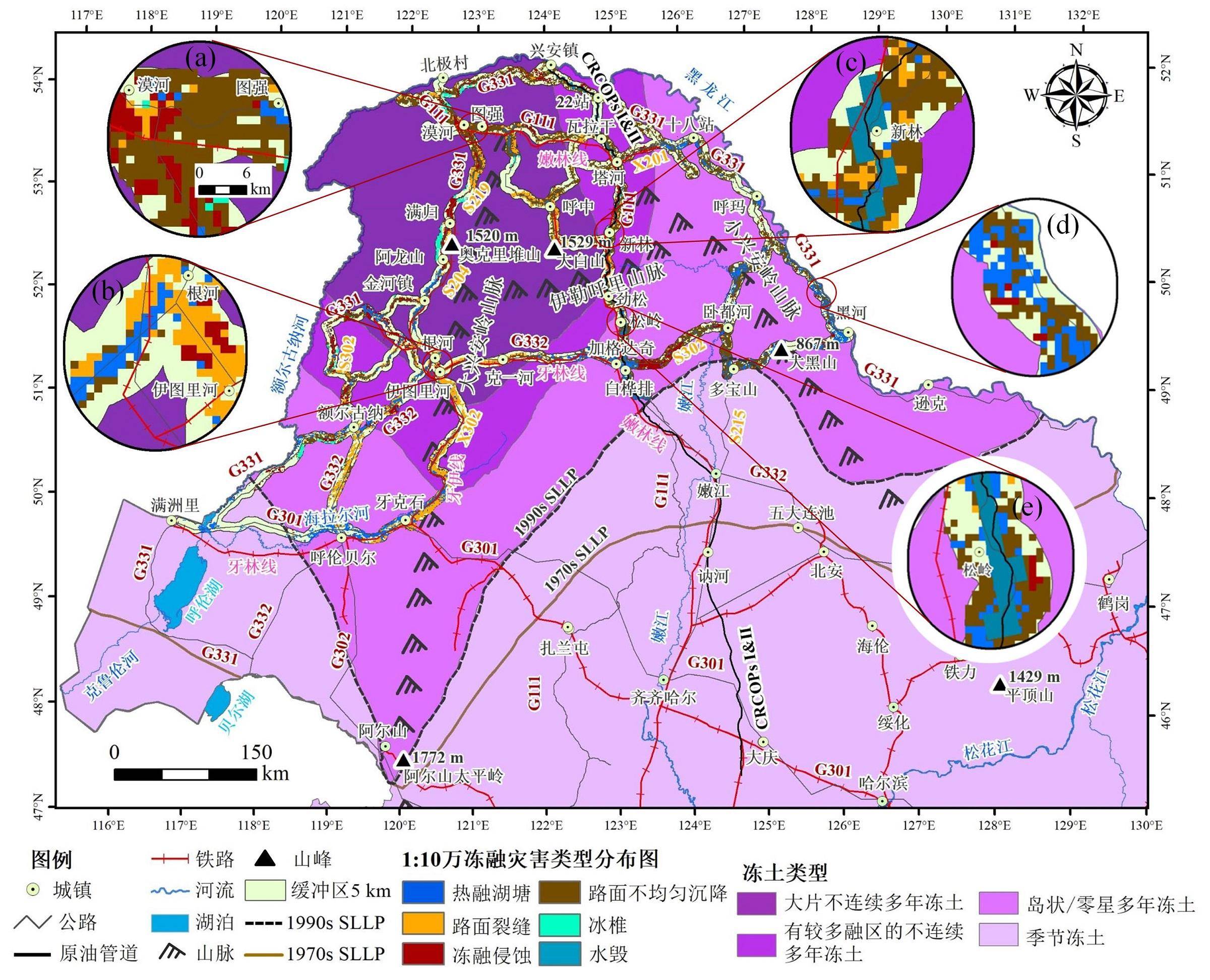
图2 东北多年冻土区30m冻融灾害类型分布图(2023-2024年)
[Data Set Special Download Address]
https://www.ncdc.ac.cn/portal/topic/detail? id=2365e106-0114-4a65-ae36-42f26cb21abe