近期,国家冰川冻土沙漠科学数据中心发布共享了中国长时间序列500m逐日积雪范围产品(1981–2000年)。该数据集由兰州大学王晓艳教授团队完成,用户可开放获取。关联论文为“A long-term daily 500 m snow cover extent product over China (1981–2000)”发表在Big Earth Data期刊。热忱欢迎广大科研工作者下载使用。
积雪是冰冻圈中分布最广泛、变化最显著的一员。其独特的高反照率、低热导率特性使其在调控地表能量收支、地气相互作用及水文过程方面发挥着关键作用。受限于早期传感器的空间分辨率、时间分辨率与可用时间序列,目前仍缺乏2000年以前、500m空间分辨率的长时间序列积雪范围(Snow Cover Extent, SCE)产品。为填补这一数据空白,研究中基于现有的SCPOT(Similar Conditional Probability & OTSU)算法,将其推广应用至整个中国地区,并针对原算法中的一些不足进行了改进。首先利用覆盖相同时间段的MODIS SCE与AVHRR SCE,计算了不同尺度下影像间的相似条件概率(SCP)。进而以1981-2000年期间内的5km AVHRR SCE为基础,在一系列后处理下生成了该套降尺度产品。
本数据集在平原及地形起伏缓和区域具有较高的稳定性与可靠性,能够清晰刻画区域尺度积雪的时空分布与季节、年际变化特征,可为冰冻圈变化、气候干湿状况分析、水资源评估等相关研究提供高质量、长时序的基础数据支撑。在青藏高原等复杂山地、高海拔山区,或对空间精度要求较高的小流域、精细制图等应用场景中,建议结合更高分辨率遥感影像或地面实测资料开展必要的局地验证,进一步提升分析结果的准确性与适用性。总体而言,该数据集填补了历史时期高分辨率逐日积雪数据的空白,在长时间序列积雪变化监测、流域水文过程模拟、冰冻圈与气候相互作用研究、生态水文评估等领域具有广泛且重要的应用潜力。
本数据产品空间分辨率为500m,时间分辨率为1天,数据命名格式为“YYYYMMDD.tif”,如“19810626.tif”,其中包含六种像元值(0=陆地,1=SCP识别积雪,2=时空立方体(STCPI)插值积雪,3=雪深插值积雪,4=水体,255=填充值)。

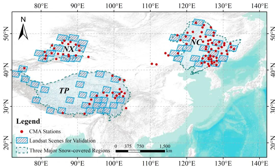
图1 研究区范围及三个典型积雪区、气象站点和Landsat-5验证数据空间分布
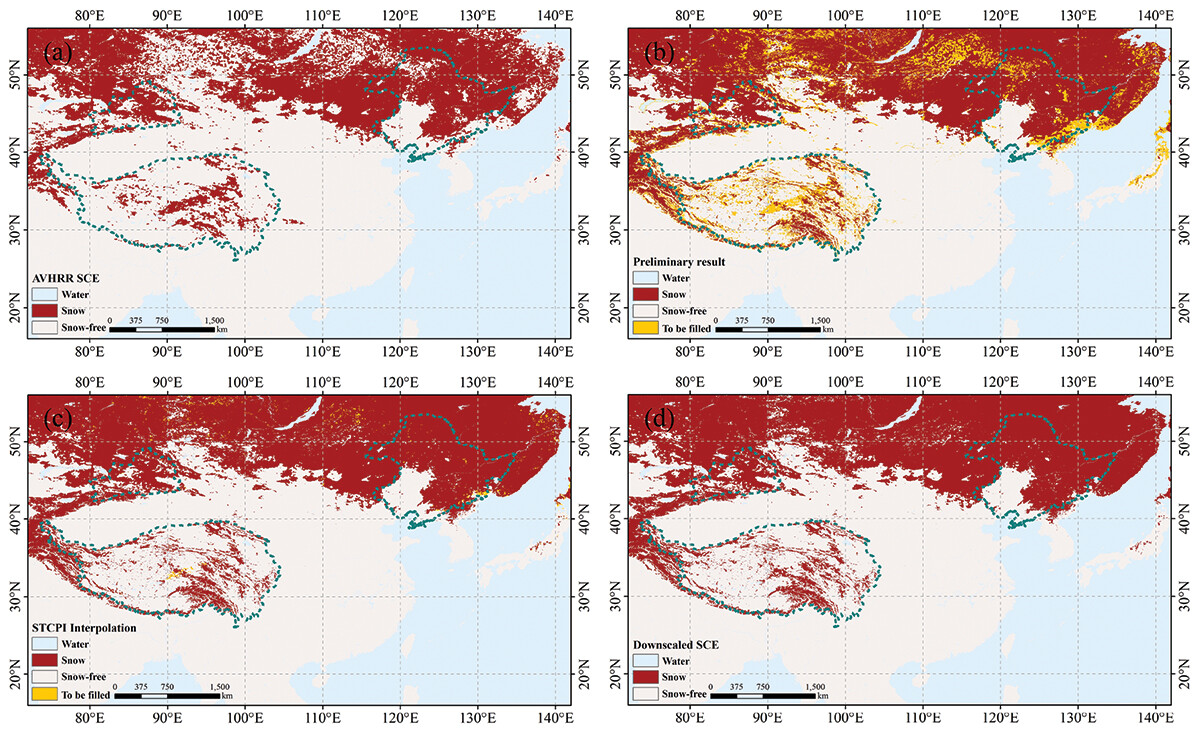
图2 降尺度各步骤处理结果对比
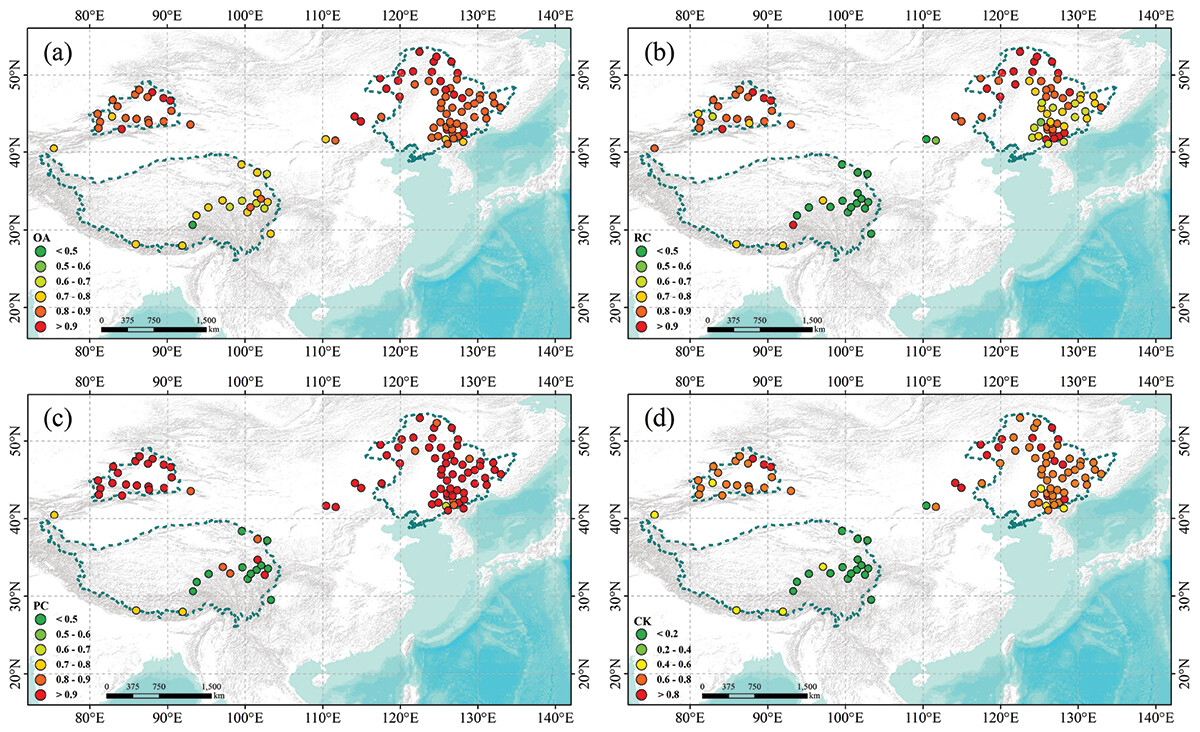
图3 各CMA站点降尺度SCE准确性的空间分布
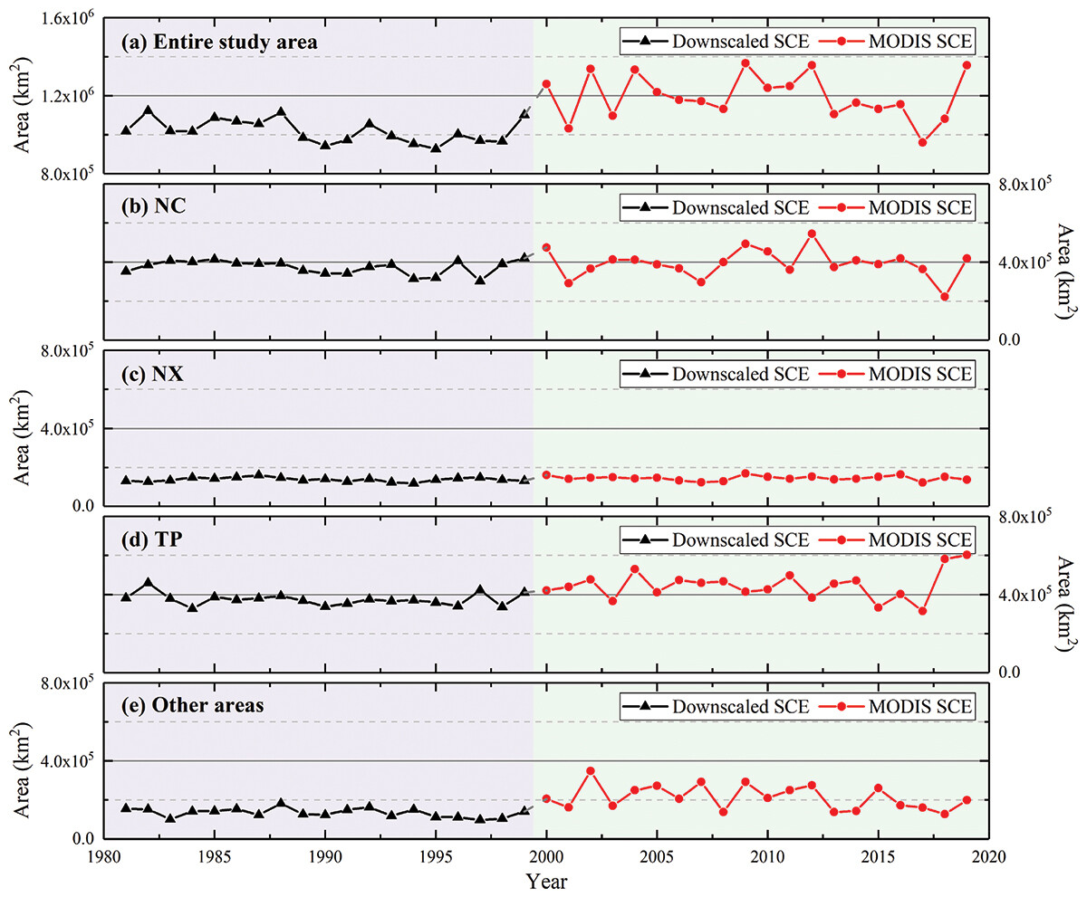
图4 基于降尺度SCE和MODIS SCE数据,分析不同地区雪盖面积的年际变化和时间连续性
【项目支持】
1. 国家杰出青年科学基金:积雪遥感(42125604);
2. 国家自然科学基金:森林冠层降雪截留遥感监测方法研究(42271373);
【文章信息】
Shen Yanlong, Wang Xiaoyan, Zhu Ruixiang, Liang Shi, Che Tao, Hao Xiaohua. A long-term daily 500 m snow cover extent product over China (1981–2000)[J/OL]. Big Earth Data, 2026, 0, (0): 1-32. DOI: 10.1080/20964471.2026.2648197.
