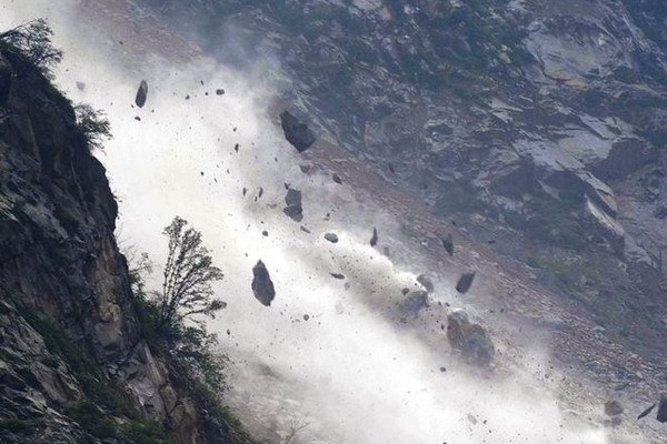
According to BBC reports, on May 28, 2025, a massive landslide occurred at the Birch Glacier in the Swiss Alps. Approximately 3.5 million cubic meters of ice, snow, and debris violently detached from the glacier summit at 3,500 meters above sea level and plunged into the valley at 1,500 meters elevation. The sliding mass, preliminarily estimated at 9 million metric tons, generated ground vibrations powerful enough to register a magnitude 3.1 event on seismic monitoring systems. The disaster buried nearly 90% of Blatten village in the valley below, leaving one person unaccounted for.
The National Cryosphere Desert Data Center (NCDC) collects and prepares basic geographic data, satellite remote sensing data, population data, topographic data and other emergency response scientific data based on disaster situations. The "Emergency response service of scientific data for Birch glacier landslide disaster in the Bratten area, Canton Valais, Switzerland (20250528)" system has been released, which provides data visualization, interoperation and data download capabilities. For use by relevant emergency, rescue and research departments.
The subsequent NCDC will continue to further collect
and sort out various data resources in the earthquake area and gradually
release them through the data center platform for the use of relevant
emergency, rescue and research departments
Service Website:
http://www.ncdc.ac.cn/portal/emergency?eid=d7dc9353-a0c9-4412-aaaa-ffb65e7ffeab&lang=en