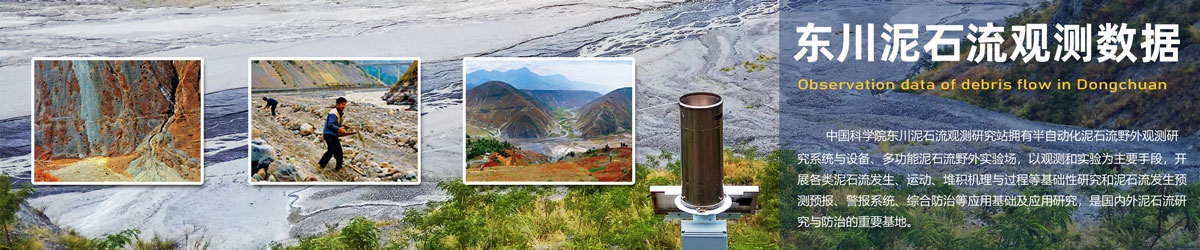
Qinghai-Tibet Engineering Corridor (QTEC) Permafrost Underground Ice Content Data Set Released
Recently, the National Glacier, Permafrost and Desert Scientific Data Center released and shared the Qinghai-Tibet Engineering Corridor (QTEC) permafrost underground ice content dataset. The dataset was completed by Lin Zhanju, a researcher team at the Northwest Institute of Ecology, Environmental Resources, China Academy of Sciences, and is open to users. The related paper is "Spatial distribution and zoning characteristics of permafrost ground ice on the Qinghai-Xizang Engineering Corridor, China" published in Advances in Climate Change Research. Scientific researchers are warmly welcome to download and use it.
Permafrost underground ice is a key solid water resource and engineering geological carrier. The frozen soil with high ice content in the Qinghai-Tibet Engineering Corridor is extremely sensitive to the response to degradation, which restricts the accurate simulation of frozen soil degradation by climate models and is also not conducive to the scientific formulation of engineering disaster prevention and control measures in fragile areas of the cryosphere.
This study is based on 1158 sets of underground borehole measured data (actual measurement, engineering survey borehole data and data shared by public literature and the Scientific Data Center), introduces two machine learning algorithms: random forest and decision tree, and combines annual average temperature, ground temperature, altitude, 13 environmental factors such as slope, and vegetation index to achieve spatial simulation of underground ice content with a resolution of 200m across the corridor. The results show that 50% of the area within the Qinghai-Tibet Project Corridor is developed with high ice content frozen soil; the average annual temperature, ground temperature, active layer thickness, altitude and precipitation are the main factors controlling the spatial differentiation of underground ice. For details, see (Fan et al., 2026)。
This study can provide basic background data for refined assessment of regional underground ice reserves, and at the same time provide scientific support for ecological protection and engineering construction design in frozen soil areas.
[Project Support]
1. Temporal and spatial changes of frozen soil on the Xizang Plateau and its impact on the water environment in cold regions (XZ202501ZY0139);
2. Distribution characteristics and refined simulation of underground ice in permafrost soil in the Qinghai-Tibet Engineering Corridor (2024M753468);
3. Strategic Pilot Science and Technology Project of China Academy of Sciences (Category B): Permafrost and Underground Ice Disaster Risk and Response (XDB0950200);
4. Study on the cryogenic structure and ice content of frozen soil profiles under local differences in the Beiluhe area (SKLFSE-ZQ-202308).
[Article Information]
FanXing-Wen, Gao Ze-Yong, Luo Jing, Niu Fu-Jun, Li Wen-Jiao, Wu Xu-Yang, Lin Zhan-Ju. Spatial distribution and zonation characteristics of permafrost ground ice on the Qinghai‒Xizang Engineering Corridor, China[J/OL]. Advances in Climate Change Research, 2026, DOI: https://doi.org/10.1016/j.accre.2026.02.005.
[Data Set Download Address]
https://cstr.cn/CSTR:11738.11.ncdc.permafrost.db7317.2026